Data & Monitoring
We use data and evidence to help us prioritise where to work, decide what action to take and evaluate whether our projects are effective.
We make use of national and local data collection from our partner organisations to better understand our catchments. The West Cumbria Catchment Partnership has used these datasets to prioritise where we can achieve the most benefits.
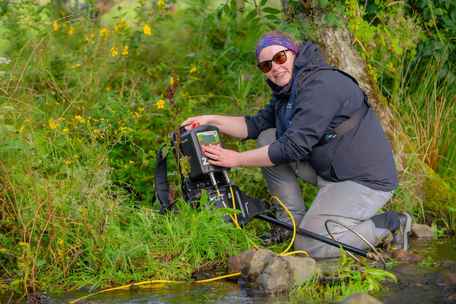
Once we have decided where to work, we do walkover surveys to see what the issues are. We conduct a fish population survey. This involves water quality monitoring and helps us understand how the water and habitat is affecting their populations. We use electrofishing techniques to conduct our fish surveys. This is a common scientific survey method used to sample fish populations. An electrical current flowing between a submerged cathode and anode briefly stuns the fish allowing them to be swept into a waiting net and removed from the water for analysis. It doesn’t do lasting damage and, when done correctly, the fish recover very soon after being caught.
We can’t monitor all of our projects but where we have used a new technique or want to understand the impact our work is having, we implement monitoring programs. Our project monitoring takes many different forms including fixed point photography, before and after wildlife surveys and river condition assessments. We are currently monitoring how effective our Natural Flood Management features are at reducing flood risk. This will help inform our future Natural Flood Management work.
We also work with Universities and the U.K. Centre for Ecology and Hydrology on research and monitoring projects.


Citizen Scientists
Get involved with data and monitoring with Citizen Science.
Data & Monitoring Projects

Catchment Partnerships

River Cocker

Fish & Habitat Surveys

Resilient Glenderamackin

River Ehen

River Irt

St John’s Beck

Rivers Waver & Wampool

Support our work
Without the help of our fantastic supporters, we’d be up the creek!